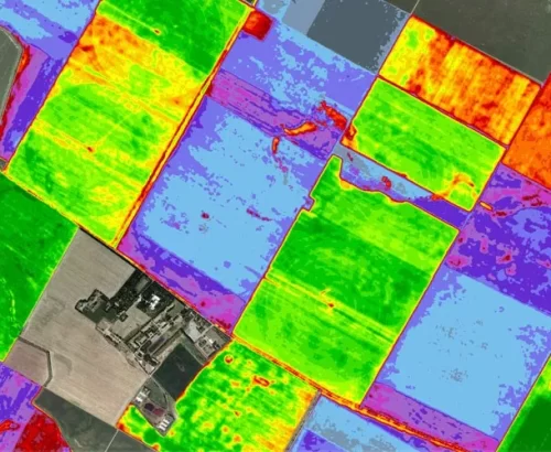
The Smart Forests and Agriculture workshop focuses on methods related to close-range and remote sensing for Earth Observation specifically of vegetation environments. Data processing methods for learning, such as artificial intelligence, and solutions for mobile acquisition such as robotics, are becoming key factors in the realm of surveying and analysis. The workshop will highlight emerging topics on data acquisition, pre-processing, information extraction, and specific down-stream applications to support data-driven and evidence-based decisions. Forests and agricultural systems pose partially overlapping challenges and surveying, processing and data analysis and representation are key aspects that are under investigation by the scientific communities.One of the aims of this workshop will also be to encourage discussions on innovative robotic operation of sensors, platforms, and AI powered processing technologies, from the perspectives of practical applications. The workshop also will encourage sharing open data sources and processing methods for extracting metrics and attributes of agriculture and forestry.

This workshop is jointly organized by:

Chair WG III/8
TESAF/CIRGEO, University of Padova, viale dell’Università 16, Legnaro, Italy
Email: [email protected]
Phone: +39 392 3952067
Francesco Pirotti is currently associate professor at University of Padova, with teaching and research on Geomatics disciplines; specific topics of interest include spatial observation data analysis, in particular surveying and remote sensing from close-range and satellite Earth observation from space oriented towards environmental applications. He has formal roles of responsibility in the following national and international scientific societies: ISPRS – International Society of Photogrammetry and Remote Sensing, working groups since 2012 in the past as secretary and co-chair and currently as chair of ISPRS WG III/8 “Remote Sensing for Agriculture and Natural Ecosystems”; EARSeL – European Association of Remote Sensing Laboratories as chair of the Agriculture special interest group (SIG); SIFET – the national scientific society of photogrammetry and surveying since 2016, in the past in the Scientific Committee and currently as Secretary to the Directive Council.

Chair of WG III/1
Wuhan University
Luoyulu 129 - 430079, Wuhan - China
Email: [email protected]
Phone: +86 2768778969
Prof. Dr. Xinlian Liang received his Doctoral degree from Aalto University (Finland) in 2013. He is a full professor in Wuhan University since 2021. He was a research manager in the Finnish Geospatial Research Institute (FGI) during 2006-2020 before joining Wuhan University. He was the Chair of the Working Group III/1 ‘Thematic Information Extraction’ (2016-2022) and ‘Remote Sensing Data Processing and Understanding’(since 2023), the International Society for Photogrammetry and Remote Sensing (ISPRS). He is the Associated Editor of Forest Ecosystems and Geo-spatial Information Science (web of science listed). Prof. Liang’s main research interest focuses on quantitative understanding forest 3D structures, characteristics, and function processes through various remote- and close- range sensing technologies, and to further investigate the interactions between forest function processes with the cycles of carbon, water, and nutrient using machine learning. In past twenty years, he had collected rich experiences on forest digitization with a wide spectrum of technologies including the laser scanning and multi-/hyper-spectral images, from terrestrial, mobile, UAV, aerial, and satellite perspectives.
Dr. Liang was listed in the World's Top 2% Scientists ranking by Stanford University in 2021, 2022 and 2023. His references in science are represented by a series of highly citied papers, e.g., ESI hot/highly cited paper (0.1%, 1% top cited paper in Geosciences, Plant & Animal Science), Google scholar matrix paper, and journal feature papers and most downloaded paper. He has an H-index 34 (ISI) and 43 (Google Scholar). Dr. Liang’s publication list includes over 100 peer reviewed papers (80+ in ISI Web of Science).

Chair of WG I/7
Finnish Geospatial Research Institute Vuorimiehentie 5 02150 Espoo, Finland
Email: [email protected]
Phone: +358 50 3478903 +358 9 295 55 211
Yunsheng Wang is Senior Research Scientist with the Department of Remote Sensing and Photogrammetry, Finnish Geospatial Research Institute (National Land Survey of Finland), Masala, 02431, Finland