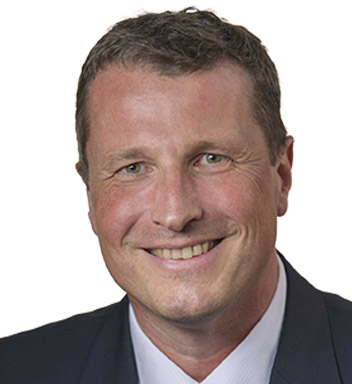
Remote Sensing Department
Vienna University of Technology
Monitoring Soil Moisture and Flooding in Arid Environments with Radar Satellite Constellations
In arid regions, water is the primary limiting factor for all forms of life. The scarcity of water influences every aspect of life, from ecosystem health to agricultural production and human wellbeing. Even so, storms can occasionally bring intense rainfall that can lead to significant flooding in areas that have little capacity to handle large volumes of water. This sudden influx of water can cause rivers to overflow, erode the land surface, and overwhelm drainage systems. For these reasons, it is as important to monitor hydrological processes in arid environment as in more humid environments. In this contribution I will examine the capabilities of three European services to monitor soil moisture and flood extent in arid environments: The H SAF service of EUMETSAT uses C-band backscatter data acquired by the Advanced Scatterometer (ASCAT), which has been flown on board of a series of three Metop satellites, to provide coarse-resolution (15-25km) soil moisture data with sub-daily revisit times. The Copernicus Land Monitoring and Emergency Management services use C-band backscatter measurements acquired by the Sentinel-1 Synthetic Aperture Radar mission to provide flood maps at 20 m and soil moisture at 1km respectively. Although the ASCAT and Sentinel-1 backscatter measurements differ in terms of spatial and temporal resolution, they both measure the same physical property: the backscatter coefficient at two nearby C-band frequencies (5.255 GHz for ASCAT and 5.405 GHz for Sentinel-1). This frequency range is especially sensitive to water, whether within the soil or on its surface. Given that vegetation cover is typically low in arid environments, it might hence be expected that retrieving soil moisture and flood extent in these regions is relatively straightforward. Unfortunately, the opposite is true. The challenges are manifold. First, among all ice-free land surface areas, backscatter shows the greatest variation in arid environments. It can be very high over rough rock or stony surfaces, and extremely low over deep sand. Second, under dry conditions, C-band waves penetrate deep into the soil, making the measurements sensitive to subsurface scatterers. This results in a situation where (i) backscatter from deep sand is as low as for flood water, and (ii) backscatter does not have a unique relationship to soil moisture. Consequently, flood mapping and soil moisture retrieval are highly uncertain in many arid regions. After discussing how the three European services deal with this situation, I will explore potential approaches to enhance the radar-based soil moisture and flood data through the development of new algorithms, the incorporation of additional data, or a combination of both. Additionally, I will highlight how the pronounced backscatter signals in arid environments could offer valuable insights for creating new soil maps.

Professor and former Head of the Department of Geomatics Engineering
University of Calgary
From Mobile Mapping to Autonomous Systems: State of the Art and Future Trends
The evolution of integrated navigation systems has been transformative, progressing from their foundational role in mobile mapping to their critical function in autonomous systems. This keynote will explore the state-of-the-art technologies driving this transition and examine future trends shaping the field. Mobile mapping relies on navigation systems, cameras, LiDAR, and other sensors to accurately geo-reference and map street-level environments. These same sensors, when used in autonomous systems, shift from passive data collection to active real-time perception and decision-making, enabling safe and precise navigation. This presentation will highlight how advancements in sensor fusion, GNSS-aided and GNSS-denied navigation, and AI-driven processing are enhancing system accuracy, continuity, and resilience. The discussion will cover the design approaches, capabilities, and limitations of integrated navigation systems, emphasizing their ability to operate seamlessly in complex environments—regardless of weather, lighting, or infrastructure constraints. Real-world implementations will illustrate current performance levels and future possibilities, demonstrating how navigation solutions are evolving to meet the growing demands of automation. As industries increasingly adopt autonomous technologies in transportation, logistics, robotics, and smart cities, the need for robust and intelligent navigation is more critical than ever. This keynote will provide insights into the technological breakthroughs shaping the next decade, paving the way for a future where autonomous systems navigate safely and efficiently in any environment.

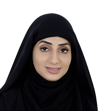
Professor of Geography and Urban Sustainability
United Arab Emirates University (UAEU)
Preparing the Next Generation for Geospatial Careers
The rapid evolution of geospatial technologies, artificial intelligence (AI), and big data analytics is significantly transforming workforce requirements, necessitating a shift in geospatial education to align with industry demands. Traditional curricula, while providing strong theoretical foundations in cartography, remote sensing, and GIS, often lack sufficient integration of emerging technologies such as AI-driven spatial analysis, cloud computing, and real-time geospatial data processing. To bridge this gap, academic institutions must modernize their curricula by incorporating industry-relevant technical skills, interdisciplinary approaches, and experiential learning methodologies to ensure graduates are equipped for the evolving job market. Collaboration between academia and industry plays a critical role in enhancing student employability. Internships, industry partnerships, and applied research initiatives provide students with hands-on experience, fostering problem-solving skills and technological proficiency. Additionally, the adoption of advanced learning methodologies, including cloud-based GIS applications, AI-powered geospatial modeling, and virtual simulation environments, enhances practical training and facilitates a deeper understanding of real-world geospatial challenges. Furthermore, competency-based learning models, project-based assessments, and interdisciplinary collaborations encourage students to apply geospatial knowledge across diverse domains such as urban planning, environmental sustainability, disaster management, and precision agriculture. Expanding open-access geospatial education initiatives is crucial for fostering inclusivity and addressing skill shortages in the global geospatial workforce. Online learning platforms, open-source GIS tools, and collaborative digital resources enable wider participation, particularly in developing regions where access to specialized training may be limited. These initiatives contribute to the diversification of the geospatial talent pool and promote equitable access to cutting-edge technological education. To meet the demands of a rapidly changing labor market, geospatial education must evolve through curriculum innovation, enhanced industry collaboration, and the integration of emerging technologies. By fostering a workforce equipped with specialized geospatial skills, analytical competencies, and adaptive problem-solving abilities, academic institutions can contribute to the development of a highly skilled, future-ready workforce capable of driving innovation and addressing complex geospatial challenges in the 21st century.

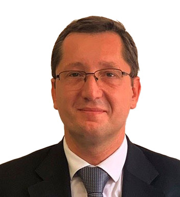
Full Professor
Universitat Politècnica de Catalunya
Innovations in Remote Sensing: From Microwave Radiometry to GNSS-R and Beyond
Over the past three decades, our research has focused on developing novel technologies and methodologies for Earth observation, particularly for soil moisture measurements – a critical parameter for understanding climate change, improving weather forecasts, and optimizing agricultural practices. This presentation chronicles a journey that started in 1993 by revising the basic equations of synthetic aperture microwave radiometry which ultimately led to the MIRAS instrument (Microwave Imaging Radiometer by Aperture Synthesis), single payload of ESA SMOS mission in 2009. The work further progressed to compact CubeSat solutions, incorporating microwave radiometry and GNSS-Reflectometry, as proven in the FSSCat mission, highlighting key technological breakthroughs and their commercial applications.
Our work began in 1993 developing the basic equations governing synthetic aperture microwave radiometry, conceiving innovative calibration and image reconstruction techniques which ultimately led to the MIRAS instrument (Microwave Imaging Radiometer by Aperture Synthesis), single payload of ESA SMOS mission in 2009. These developments helped overcome fundamental challenges in interferometric radiometry, enabling high-resolution soil moisture measurements from space. As Radio Frequency Interference (RFI) emerged as a significant challenge for microwave radiometry, we pioneered detection and mitigation algorithms that have become standard practice in the field, and that are being implemented in the correlator chips of the future SMOS follow-on mission.
The pursuit of more cost-effective solutions led us to explore GNSS-Reflectometry (GNSS-R), a paradigm shift in remote sensing that uses existing navigation signals as sources of opportunity. Our research demonstrated GNSS-R’s capabilities for soil moisture retrieval, particularly through the development of novel algorithms and experimental campaigns. This work culminated in several CubeSat missions, and notably the FSSCat mission, 2017 Copernicus Masters competition winner, proving that meaningful Earth observation data could be obtained from small satellite platforms at a fraction of the cost of traditional missions.
To bridge the gap between research and commercial applications, we established Balamis, a spin-off company from the Universitat Politècnica de Catalunya (UPC), which developed innovative microwave radiometers for commercial applications. This venture evolved into MWSE, which has now developed space-flight hardware, and later to MITIC Solutions, focused in RFI detection and mitigation systems.
Our most recent developments focus on integrating multiple sensing technologies, remote and in situ, while leveraging machine learning for data fusion and interpretation for soil moisture retrieval and prediction under diverse conditions.
This presentation will discuss these technological developments, their practical applications, and the lessons learned in transferring academic research to commercial solutions. We will also address current challenges and opportunities in remote sensing, including the ongoing battle against RFI, the potential of new satellite constellations, and the role of machine learning in future Earth observation systems.
This journey from laboratory concepts to operational systems illustrates the importance of persistent innovation and the value of combining multiple technologies to address complex environmental challenges, and that successful technology transfer requires not only sound scientific foundations, but also adaptability to market needs and continuous evolution of solutions.

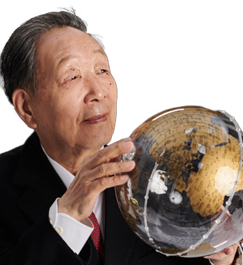
Scientist
Wuhan University, China
Spatio-temporal Intelligence for SDG
The world is material, matter is in constant motion, and this dynamic physical world is described through spatio-temporal information. In the era of Internet of Everything and artificial intelligence, spatio-temporal data acquisition, processing, information extraction and knowledge mining need to become intelligent. Thus, Prof. Deren Li proposed Spatio-temporal Intelligence, which can automatically answer questions of When, Where, What Object, What Change, and Why. Spatio-temporal Intelligence is also integral to service science, intelligently delivering right data, information, and knowledge to right people at right place and right time. This paper will describe typical applications of spatio-temporal intelligence using BeiDou, high resolution remote sensing with satellites, intelligent robots, UAVs etc. for Sustainable Development Goals (SDGs) from China.